×

Cart

Subtotal:
НАМАЛЕНИ ЦЕНИ ВО ЈУНИ - ЛИНК - ПОГЛЕДНИ ПОВЕЌЕ  

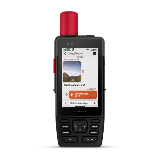
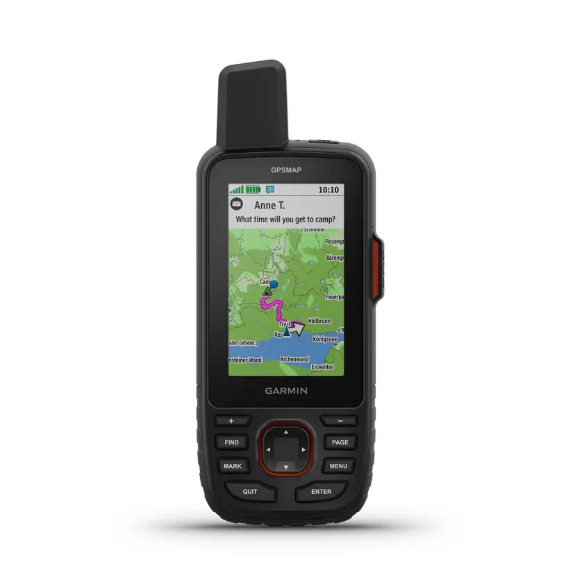
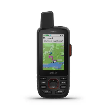
GARMIN GPSMAP 67i Europe

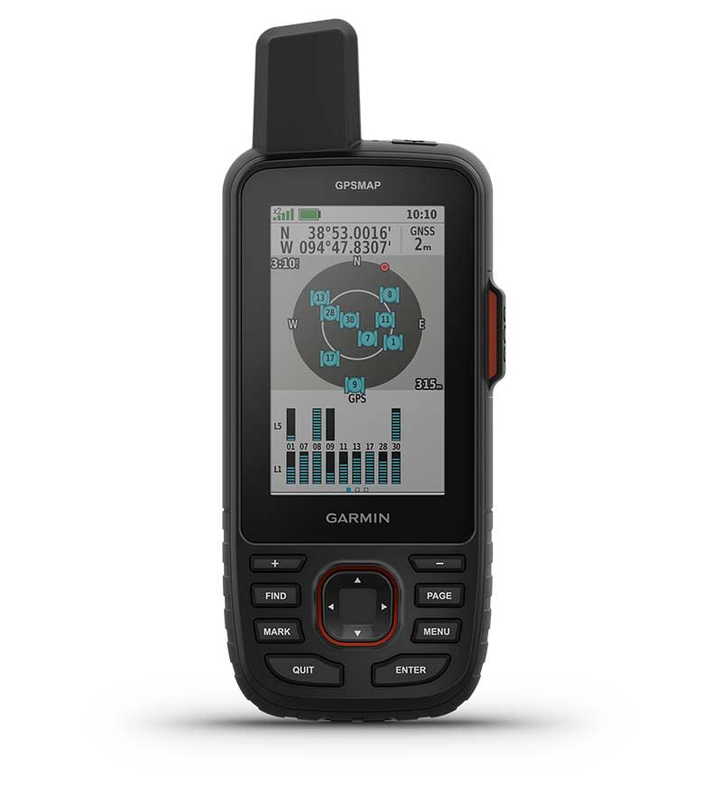
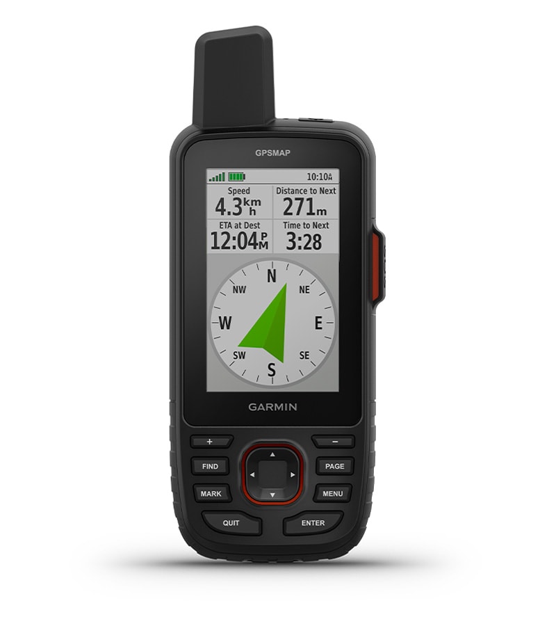
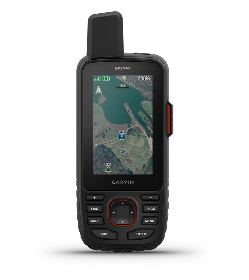
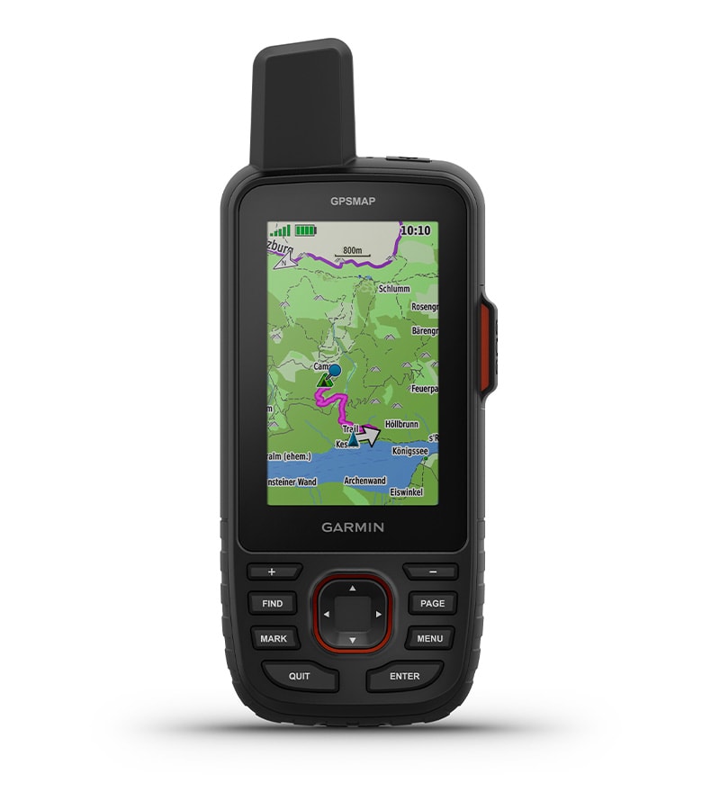
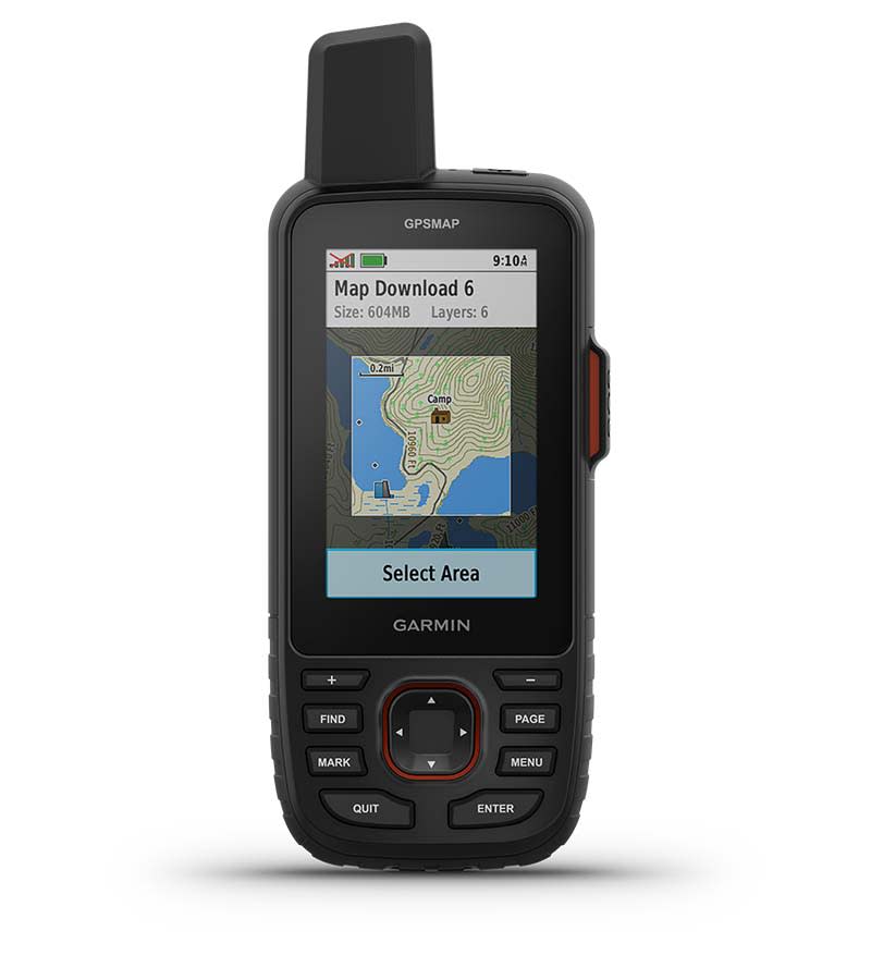
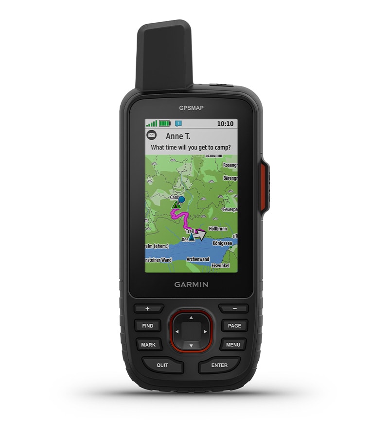
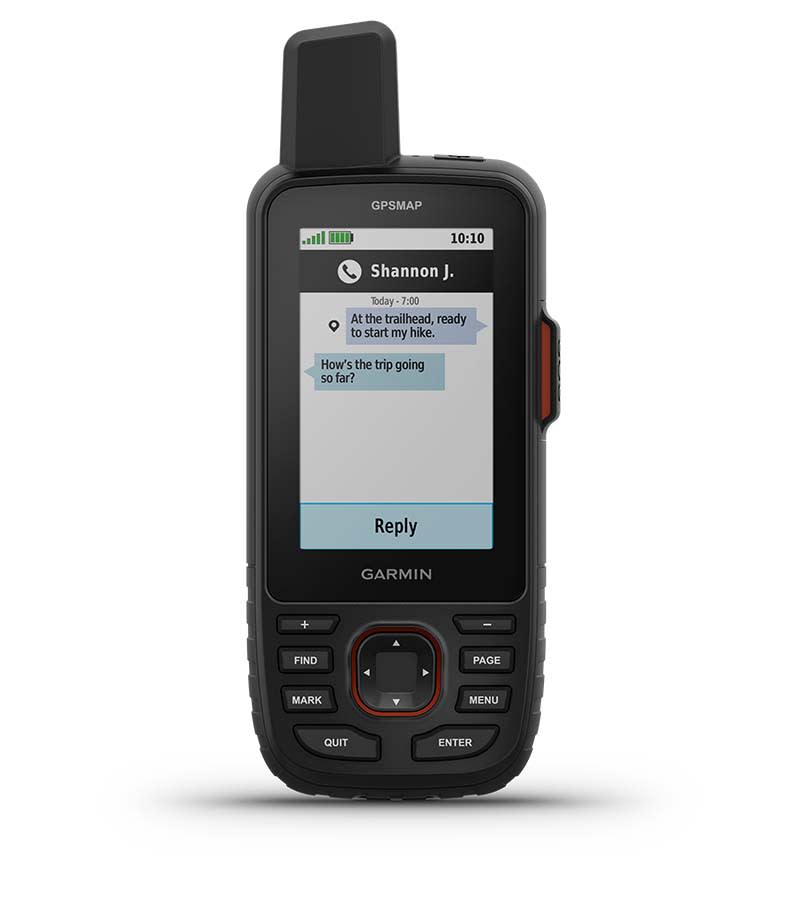
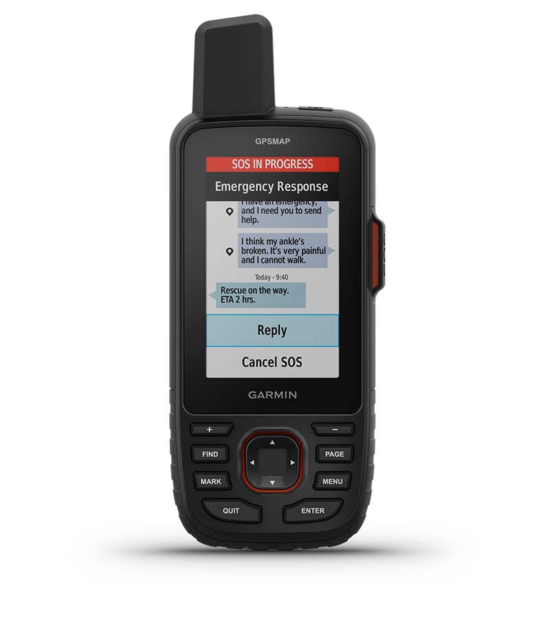
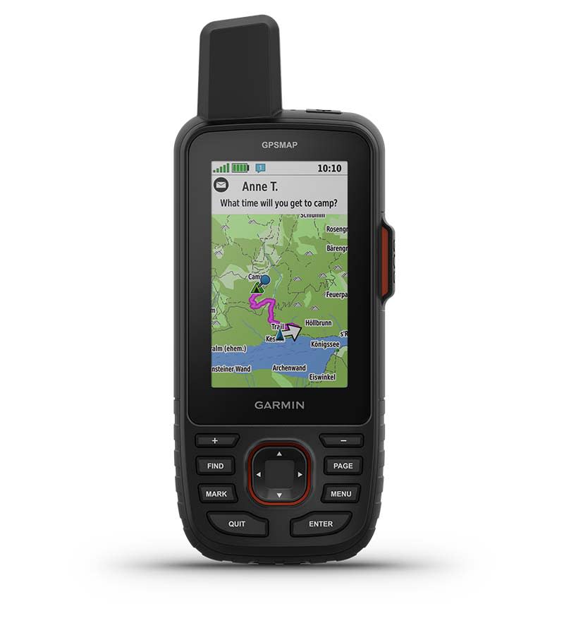
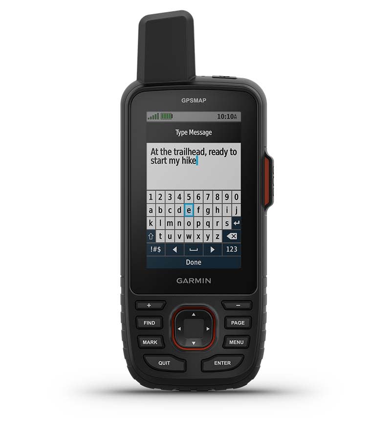
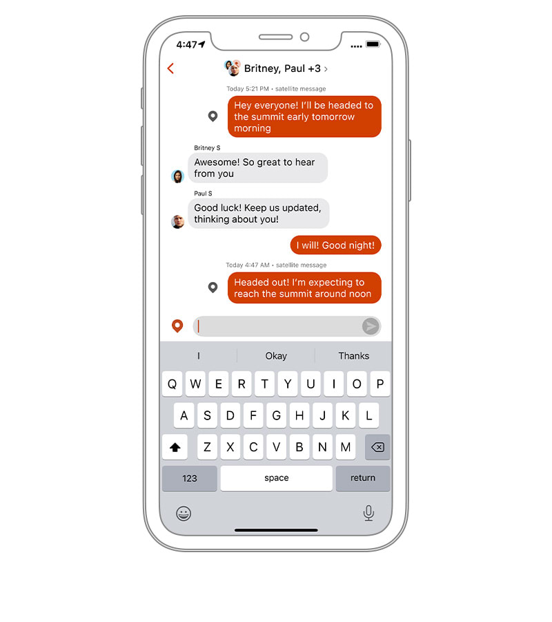
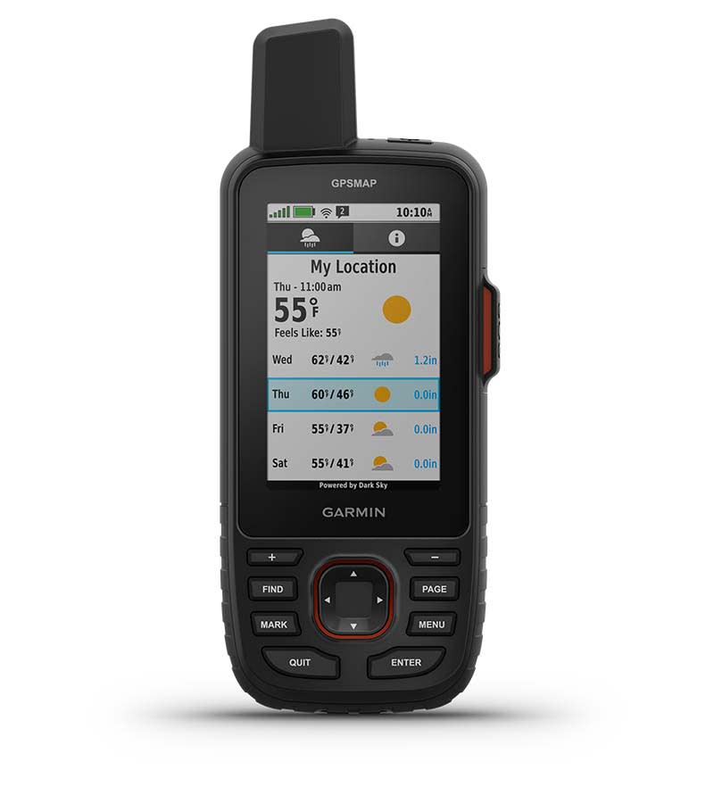
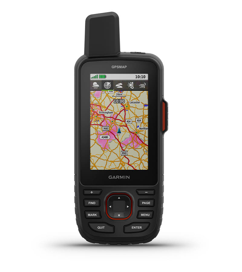
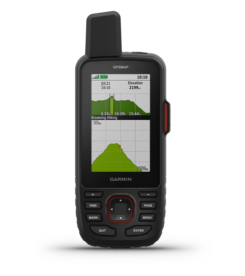
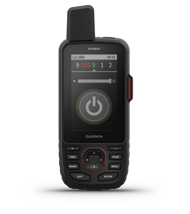
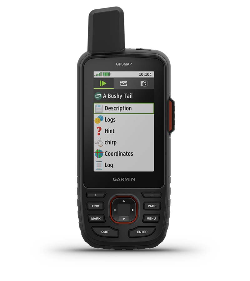
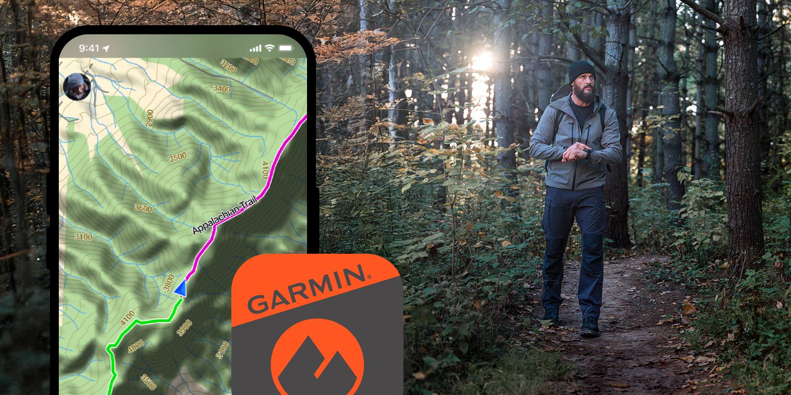
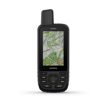
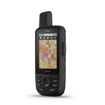
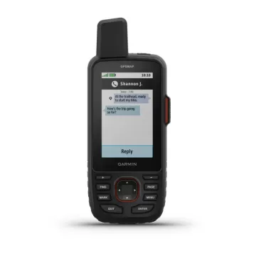
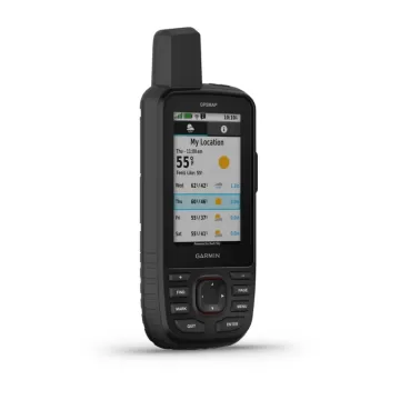
ОДЕТЕ ИСТРАЖУВАЈТЕ OUTDOOR - И ОСТАНЕТЕ ПОВРЗAНИ СО ДОМА Одвојте повеќе време за авантура со овој врвен, цврст рачен GPS и сателитски комуникатор. Добијте ја технологијата inReach® која овозможува двонасочна размена на пораки, интерактивни SOS предупредувања и споделување локација плус мапирање за да ве држи на курсот.

39.980 ден.
Достапност : Бесплатна достава во Македонија. Рок за испорака 1-3 работни дена.

Патувајте подолго со до 165 часа траење на батеријата во режим на следење и до 425 часа во режим на експедиција.

Двонасочните пораки ви овозможуваат да го споделите моментот со оние што се важни.

Дозволете им на вашите најблиски да ја следат вашата авантура со следење локација.

Дали има итен случај? Активирајте интерактивно SOS предупредување во секое време, на глобално ниво.

Следете ја вашата позиција во предизвикувачки услови со технологија со повеќе опсег и проширена поддршка за GNSS.

Discover new favourite places.

MULTI-BAND GNSS SUPPORT

Access multiple global navigation satellite systems (GPS, Galileo and QZSS). Get access to multiple frequencies sent by navigation satellites for improved position accuracy in areas where GNSS signals are reflected, weak or typically don't penetrate.

ABC SENSORS

Navigate every trail with ABC sensors, including an altimeter for elevation data, barometer to monitor weather and 3-axis electronic compass.

SATELLITE IMAGERY

Download high-resolution photorealistic maps directly to your device via Wi-Fi® technology. Easily find trails, pick stand locations and parking, create waypoints and more.

PRELOADED TOPOACTIVE EUROPE MAPS

Preloaded TopoActive Europe maps show you summits, parks, coastlines, rivers, lakes and geographical points.

PREMIUM MAP FEATURES

With an Outdoor Maps+ subscription, you get public land information, landowner names, state plat maps, BLM boundaries and more.

BATTERY LIFE

Turn on expedition mode, and get up to 425 hours of battery life while using inReach technology. In the default tracking mode, you get up to 165 hours of battery life, and your device will save your location every 10 minutes.

Keep in touch on the trail.

TWO-WAY MESSAGING

Exchange text messages with loved ones, post to social media, or communicate from inReach to inReach in the field.

INTERACTIVE SOS ALERTS

In case of emergency, trigger an interactive SOS message to the Garmin ResponseSM centre, a 24/7-staffed professional emergency response coordination centre.

LOCATION SHARING

Track your location and share it with those at home or out in the field. They'll be able to see your progress or ping your device for your GPS location and more.

100% GLOBAL IRIDIUM® SATELLITE NETWORK

Instead of relying on mobile phone coverage, now your messages, SOS alerts and tracking are transferred via the global Iridium satellite network.

GARMIN MESSENGER™ APP

Download the Garmin Messenger app to your compatible smartphone, and pair it with your GPSMAP® 67i handheld GPS for fast, easy messaging and 24/7 SOS that's not limited to mobile phone coverage areas1. The app supports group messaging as well.

GARMIN EXPLORE™ APP

Plan, review and sync waypoints, routes and tracks by using the Garmin Explore app and website. You can even review completed activities while still in the field.

OPTIONAL INREACH WEATHER

Use inReach connectivity to get detailed weather updates on the GPSMAP 67i handheld GPS. Request weather forecasts for your current location, waypoints or destinations on your route.

ACTIVE WEATHER

When connected to the Garmin Explore smartphone app , you can get real-time forecast information, so you're aware of the changing conditions.

Find your way for days.

BUILT FOR ADVENTURE

This handheld is built to military standards for thermal, shock and water performance (MIL-STD-810), and it's even compatible with night vision goggles.

LED FLASHLIGHT

The GPSMAP 67 series handheld helps you keep gear to a minimum with a built-in LED flashlight that can be used as a beacon to signal for help.

GEOCACHING

Get automatic cache updates from Geocaching Live, including descriptions, logs and hints. When connected via Wi-Fi technology or to the Garmin Explore™ smartphone app, each find will upload to your Geocaching.com profile.

Garmin Explore app for off-grid navigation and more.

LEARN MORE

Communicate globally with inReach® satellite technology.

LEARN MORE

Satellite subscription required. Some jurisdictions regulate or prohibit the use of satellite communication devices. It is your responsibility to know and follow all applicable laws in the jurisdictions where the device is intended to be used.
Wi-Fi is a registered trademark of the Wi-Fi Alliance.

TestVar id: 35 userid: 17 name: GARMIN Oregon 750t TopoActive Europe VIP: 0 cat: 46 subcat: 3 subsubcat: 0 manufacturer: model: status: 1 image1: 17_2024_81511714007340.webp image2: 17_2024_64531714007340.webp image3: 17_2024_73261714007340.webp image4: 17_2024_42181714007340.webp image5: 17_2024_47611714007340.webp image6: image7: image8: image9: image10: image11: image12: short_description: <h3>Rugged GPS/GLONASS Handheld with Built-in Wi-Fi&reg;, Camera and TopoActive maps</h3> <ul> <li>Enhanced antenna enables better GPS and GLONASS reception and performance; 3-axis compass with accelerometer and barometric altimeter sensors</li> <li>3-inch sunlight-readable touchscreen with dual orientation (landscape or portrait view)</li> <li>Expanded wireless connectivity (Wi-Fi, Bluetooth<sup>&reg;</sup>, ANT+<sup>&reg;</sup>&nbsp;capable); includes Smart Notifications<sup>1</sup>&nbsp;and automatic uploads to Garmin Connect<sup>&trade;</sup>&nbsp;online community and supports Active Weather and Geocaching Live</li> <li>8 megapixel autofocus camera which automatically geotags photos</li> <li>Preloaded TopoActive Map of Europe and included&nbsp;1-year BirdsEye Satellite Imagery subscription</li> </ul> description: <div> <div><img class="bottom-s alignleft" src="https://static.garmincdn.com/en_GB/products/010-01672-31/g/at-a-glance.jpg" alt="At a Glance" width="100%" height="" border="0" /></div> <div> <div class="row top-m bottom-m"> <div class="span5"><img src="https://static.garmincdn.com/en_GB/products/010-01672-31/g/intro.jpg" alt="" width="200" height="" border="0" /></div> <div class="span10">Thanks to an enhanced antenna for better satellite reception, the Oregon 750t GPS and GLONASS handheld puts even more of the great outdoors at your fingertips. Whether you&rsquo;re hiking, biking, geocaching, climbing, kayaking, trail riding or whatever, this rugged navigator is ready for anything. It features multilink wireless connectivity (Wi-Fi, Bluetooth and ANT+), Active Weather support with animated radar overlays, a 1-year&nbsp;<a href="https://buy.garmin.com/prod70144.html" rel="noopener" target="_blank">BirdsEye Satellite Imagery</a>&nbsp;subscription and a built-in 3-axis compass with barometric altimeter.</div> </div> <h3>More Connectivity, Less Complexity<sup>1</sup></h3> <div class="row top-m bottom-m"> <div class="span9">The expanded wireless capabilities of Oregon 750t make it easier than ever to update software, receive Smart Notifications<sup>1</sup>&nbsp;check the weather radar<sup>2</sup>&nbsp;and upload adventures to&nbsp;<a href="https://connect.garmin.com/" rel="noopener" target="_blank">Garmin Connect</a>. You can even share LiveTrack location data or geocache discoveries via WiFi or smartphone. Smart Notifications via Bluetooth connectivity with a compatible smartphone let you receive emails, texts and alerts right on your device. So you can see what&rsquo;s going on while you&rsquo;re getting away from it all. Comes standard with a dual battery system that lets you use traditional AA batteries or a rechargeable NiMH power pack.</div> <div class="span9"><img src="https://static.garmincdn.com/en_GB/products/010-01672-31/g/hike.jpg" alt="" width="200" height="" border="0" /></div> </div> <div class="row top-m bottom-m"> <div class="span9"> <h3>Find Fun with Geocaching.com</h3> The wireless connectivity to&nbsp;<a href="http://www.geocaching.com/" rel="noopener" target="_blank">Geocaching.com</a>&nbsp;on your Oregon makes it easier than ever to enjoy a superior geocaching experience. You can set your device to automatically stay up to date with all the latest caches. No more manual entry of coordinates or printing out cache details on paper.</div> <div class="span9"><img src="https://static.garmincdn.com/en_GB/products/010-01672-31/g/geo.jpg" alt="" width="200" height="" border="0" /></div> </div> <div class="row top-m bottom-m"> <div class="span9"> <h3>Take Geotagged Pictures</h3> Capture locations and memories with the 8 megapixel digital camera. Each photo is automatically geotagged, allowing you to easily navigate back to that exact spot in the future. You can upload and share your favourite photos with friends via&nbsp;<a href="http://adventures.garmin.com/" rel="noopener" target="_blank">Garmin Adventures<sup>&trade;</sup></a>, part of the Garmin online community.</div> <div class="span9"><img src="https://static.garmincdn.com/en_GB/products/010-01672-31/g/geotag.jpg" alt="" width="200" height="" border="0" /></div> </div> <h3>Navigate Your Way</h3> <div class="row top-m bottom-m"> <div class="span9">The Oregon 750t handheld provides comprehensive navigation and tracking to guide you on and off the beaten path, using GPS and GLONASS plus ABC (altimeter, barometer and compass) sensor capabilities. The built-in altimeter provides elevation data to accurately monitor ascent and descent, while the barometer can be used to predict weather changes by showing short-term trends in air pressure. The 3-axis electronic compass keeps your bearing, whether you&rsquo;re moving or not. There&rsquo;s also a TracBack<sup>&reg;</sup>&nbsp;feature on Oregon 750t to help you navigate back to your starting point the same way you came. You can also mark locations, such as your campsite, vehicle or other points of interest, to which you'd like return navigation.</div> <div class="span9"><img src="https://static.garmincdn.com/en_GB/products/010-01672-31/g/nav.jpg" alt="" width="200" height="" border="0" /></div> </div> <h3>Enjoy the View on a Vivid Display</h3> <div class="row top-m bottom-m"> <div class="span9">The Oregon 750t handheld features a bright, sunlight-readable 3-inch colour touchscreen display with dual orientation for landscape or portrait views. It easily supports multiple mapping options such as&nbsp;<a href="https://buy.garmin.com/prod6452.html" rel="noopener" target="_blank">BlueChart<sup>&reg;</sup>&nbsp;g2 HD</a>&nbsp;for water navigation or&nbsp;<a href="https://buy.garmin.com/c452-c454-c496-p1.html" rel="noopener" target="_blank">City Navigator<sup>&reg;</sup>&nbsp;NT&nbsp;</a>for turn-by-turn driving directions. Durable and&nbsp;<a href="http://www.garmin.com/waterrating/" rel="noopener" target="_blank">water-rated to IPX7</a>, the Oregon series is built to keep delivering vital mapping and tracking data, no matter what the elements throw at you. Plus, you can even customise your Oregon&rsquo;s display with free downloads from the&nbsp;<a href="https://apps.garmin.com/" rel="noopener" target="_blank">Garmin Connect IQ<sup>&trade;</sup></a>&nbsp;online store<sup>3</sup>.</div> <div class="span9"><img src="https://static.garmincdn.com/en_GB/products/010-01672-31/g/sideview-700.jpg" alt="" width="200" height="" border="0" /></div> </div> <h3>Plan Your Next Trip</h3> Take charge of your next adventure with&nbsp;<a href="http://www.garmin.com/basecamp/" rel="noopener" target="_blank">BaseCamp</a>&trade;, software that lets you view and organise maps, waypoints, routes and tracks. This free trip-planning software even allows you to create Garmin Adventures that you can share with friends, family or fellow explorers online. BaseCamp displays on your computer screen any topographic map data stored on the device, including contour lines and elevation profiles. It also can transfer an almost unlimited amount of satellite images to your device from the included 1-year BirdsEye Satellite Imagery subscription. <p class="disclaimer-block"><sup>1</sup>When paired with a compatible smartphone.&nbsp;See&nbsp;<a href="http://support.garmin.com/support/searchSupport/case.faces?caseId=%7bbbfc9660-8f77-11e3-d5f4-000000000000%7d" rel="noopener" target="_blank">garmin.com/ble</a>&nbsp;for compatibility. <sup>2</sup>Active Weather is available in the UK, Ireland, Portugal, Spain, France, Germany, Belgium, Netherlands, Luxembourg, Switzerland, Denmark, Norway, Sweden, Finland, Austria and Slovenia with partial coverage in Northern Italy. <sup>3</sup>Apps, widgets and data fields will be introduced when they become available; not all products may be available all the time. Please check our&nbsp;<a href="https://apps.garmin.com/" rel="noopener" target="_blank">website</a>&nbsp;for current inventory of Connect IQ products.</p> <p class="disclaimer-block">The Bluetooth&reg; word mark and logos are registered trademarks owned by Bluetooth SIG, Inc. Wi-Fi<sup>&reg;</sup>&nbsp;is a registered trademark of the Wi-Fi Alliance.</p> </div> </div> characteristics: meta_title: meta_keywords: meta_description: url: measure: order_by: 0 date_created: 2024-10-14 15:55:14 width: profile: diameter: fuel_efficiency: wet_grip: noise: image: 17_2024_81511714007340.webp price: 34980.00 price2: 0.00 item_id: 33

Слични продукти